
Feb 21,2024
Once again we awoke early with enthusiastic sprits to get breakfast and get out to see Joshua Tree NP. Having done this a couple of times, everything works like a Swiss watch. The water, the food, the hiking supplies, all in its place without having to think about it.
Soon we were out on I-10 heading towards Los Angeles. Mountains on every side, a huge wind farms on both sides, and dramatic clouds shrouding the mountains! It didn’t take long to arrive at state route 62 that would take us up into Joshua Tree. The little Bolt EUV was comfortable and performed well. I really like the visibility, the controls and the comfort. But I did have a little nagging worry as we climbed into the park. Climbing into the mountains was taking a lot more “estimated miles” than we were traveling. As we arrived at the main entry gate to Joshua tree, we had traveled less than 50 miles , but our estimated miles remaining had dropped from 220 to 115. We had already used 1/2 of the budgeted energy, and had just entered the park. I told Alice that we should probably not try to go in all the way to our planned High View hike. Instead we stopped at the first major stop with a parking lot at Quail Springs. We should really try to find an interesting hike right here and not go further into the park without some guarantee of e-charging. There would be nothing inside the park.
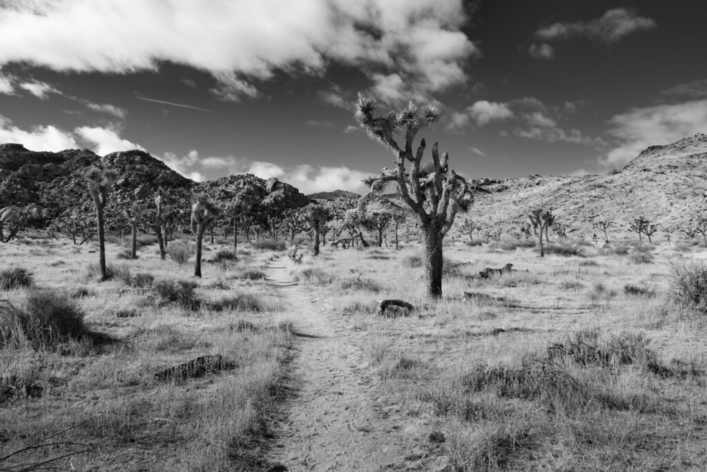
Alice stepped out to the west with no particular trail in sight, straight into the endless desert. Usually we try to plan our hikes, and it’s important to have a good plan and trail in the desert. There were a couple of what looked like baby carriage wheels heading this way. I pulled out Gaia GPS app, and fortuantely had downloaded the maps for the whole park, so did not need a cell connection. Sure enough, there was a named trail heading close to us Just trurning a bit to the left and we definitely picked up the official Quail Springs Historic Trail. Within 15 minutes we came to a trail intersection. The left direction looked very promising as it seemed to wind up into the hills and ridges. But the trail did not exist on our map. We headed southwest amonst the yucca trees, giant piles of sandstone boulders with other rocks as well. There were birds out moving in and out of trees and bushes.

Though there was no trail on our interactive GPS map, it did track our progress and give us a route to follow back and tell us exactly where we were in relation to our starting point. This gave us confidence to proceed forward. Soon we came to the actual Quail wash. In western parlance, these are the swaths that water can sluice down after a rainstorm, and can be dangerous after a downpour. Today the wash was dry despite the rain that had fallen even last night.
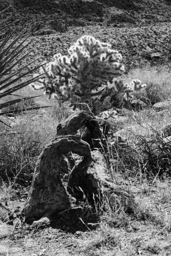
We kept a steady course, and it was becoming very clear that the NPS had carefully laid clues and natural materials for this trail to keep us on track. Sometimes just an old tree trunk blocking an alternate route. Sometimes steps constructed out of granite. As we chatted we decided we could continue on this trail for an hour before turning back, or until some natural ridgetop. We circled around rock formations, beside cliffs, and gradually increasing in elevation. Finally at about the one hour mark, we came to a high point with dark rocks scattered around and decided to stop here for our half way break. As we inspected these rocks, they clearly were not just rocks. We were in a petrified forest and the dark striped rocks were petrified trees! No mention of this with a sign. In fact there were no signs and no other people on the entire hike.


The return route was easy and mostly downhill. No longer did we have the intrigue and uncertainty of where we would end up.

Our return went perfectly. we had not trouble getting back to our starting point and the increasing press of tourists all stopping to step outside their car and snap a cell phone picture, only to get back in and drive some more. Didn’t they know that the hike of a life time lay just to their West?

It was time to head back into town. We needed to find a charging station with only 100 miles left on our battery. We learned of a charging station in Yucca Valley, which we easily found behind the RiteAid. We connected up were about to leave when another man about my age pulled up in an identical Bolt and told me his story, as well as how he navigates the limited range. He reassured me that I would arrive in Palm Springs with the same remaining mileage as I had leaving Yucca Valley. The significant drop in elevation would charge the battery. I was thankful for his experience and advice. We found a nice little natural restaurant across the street as the car charged. Upon our return we had 218 miles estimated. We headed back to Palm Springs feeling that we had not been robbed , but had a wonderful hike. sure nough, the estimated remaining miles was about 218 miles as we pulled into our hotel parking lot.
Nevertheless, I went back to the airport and exchanged the car for a gas car. Range anxiety is real when you are in the remote desert lands of the west with no water, no cell phones, etc.

Photos are beautiful!
Thanks, Gary. I know that you appreciate the desert southwest, and now I know why.
Beautiful
Thanks, David!